

How Can Agricultural Drones Slash Chemical Use and Boost Yield?
2025-10-11
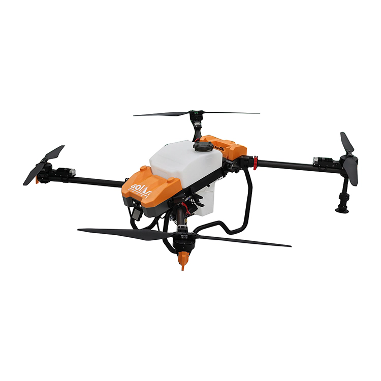
In modern farming, a UAV drone for agricultural use is an aircraft without onboard human pilots, tailored specifically for tasks like crop monitoring, precision spraying, field mapping, and more. These drones carry specialized sensors, cameras, and payload systems (spray nozzles, seed spreaders, etc.) to perform agricultural tasks at scale.
They are also often referred to as agricultural drones or ag-UAVs.
Key Functional Capabilities
-
Remote sensing & imaging: RGB, multispectral, thermal sensors
-
Aerial spraying / fertilization / pesticide application
-
Field mapping, terrain modeling, and 3D reconstructions
-
Variable rate application: applying inputs differently across zones
-
Autonomous flight paths / mission planning / swarm operations
In practice, the UAV flies over farmland following preplanned flight paths (or in coordinated swarms), captures data and/or dispenses inputs, and returns safely to recharge or refill.
Why Use a UAV Drone in Agriculture?
Increased Efficiency & Cost Savings
Agricultural drones can significantly reduce labor, time, and resource costs. For example, instead of tractors or manned aircraft, a drone can treat large acreage quickly and with lower input waste.
By targeting treatment only where needed, drones reduce the volume of chemicals, water, and fertilizers applied, which lowers operational costs and environmental impact.
Environmental Sustainability
Drones enable precision agriculture—only stressed or diseased zones are treated, reducing runoff, pollution, and overapplication.
Case in point: globally, agricultural drones have contributed to saving ~222 million tons of water while cutting chemical use and carbon emissions.
Enhanced Data & Decision Support
With high-resolution imaging (multispectral, thermal, RGB) and AI analytics, drones can detect early signs of disease, water stress, nutrient deficiency, or pest infestation—before symptoms are visible to the farmer.
This allows timely interventions and smarter resource allocation.
Overcoming Terrain & Labor Constraints
In hilly, remote, or fragmented land, ground equipment may struggle. Drones can reach hard-to-access zones and treat them autonomously.
Also, in many regions labor is scarce—drones help fill that gap.
Market Growth & Adoption Trends
The agricultural drone market is growing rapidly: valued at ~$5 billion in 2025 and forecast to reach ~$13 billion by 2030 (CAGR ~19 %)
Regulatory easing, Drone-as-a-Service (DaaS) models, and swarming permission (e.g. in the U.S.) are accelerating adoption.
Swarming drones (multiple units coordinated by a single operator) are gaining traction—for instance, FAA allowing one operator to oversee three >55 lb spray drones.
How the UAV Drone for Agriculture Works
Core System Architecture & Workflow
-
Mission Planning: Define field area, flight altitude, overlap, speed, spray zones, waypoints
-
Takeoff & Navigation: Drone autonomously follows GPS/RTK path
-
Data Capture / Application: Use sensors (multispectral, thermal) or perform spraying/fertilization
-
Return & Refill / Recharge
-
Data Postprocessing & Analytics: Software analyzes collected imagery and generates insights
Key Technologies Enabling Performance
| Component | Purpose & Capability |
|---|---|
| GNSS / RTK / RTK-GPS | Centimeter-level positioning for precise flight paths |
| Multispectral & RGB Sensors | Capture crop health indices (e.g. NDVI) |
| Thermal Sensors | Detect water stress or irrigation issues |
| Spray Payload System | Nozzles, pumps, and flow control for precise application |
| AI & Machine Learning | Automate pattern recognition and decision support |
| Swarm Control / Fleet Management | Coordinate multiple drones from one operator |
| Obstacle Avoidance / Radar / LiDAR | Safety in complex field environments |
Operation Best Practices & Safety
-
Fly under suitable wind and weather thresholds to avoid spray drift
-
Maintain appropriate altitude and speed relative to crop canopy
-
Calibrate nozzles and droplet sizes to match chemical requirements
-
Monitor battery levels, payload weight, and flight stability
-
Comply with local aviation regulations and obtain necessary certification
-
Use overflight boundaries and geofencing to avoid no-fly zones
Scaling via Drone-as-a-Service (DaaS) & Swarm Deployment
For large farms or regions, operating your own drone fleet may be complex. Many agricultural tech providers now offer DaaS—where farmers “rent” drone service rather than buy hardware outright.
Swarm deployment (multiple drones flying in concert) can drastically reduce labor overhead: e.g. U.S. approvals now allow single operator control over three heavy drones.
Product Parameters & Technical Specifications
Below is a representative specification set for a high-end agricultural UAV system (your actual product may vary):
| Specification | Typical Value / Range | Notes |
|---|---|---|
| Payload / Tank Capacity | 20 L to 100 L | depending on model |
| Maximum Flight Time | 6 to 20 minutes | depends on weight and battery |
| Spray Flow Rate | 1–6 L/min (adjustable) | For fine control |
| Positional Accuracy | ± 2–5 cm (with RTK) | for precision in application |
| Imaging Sensors | RGB, multispectral (4–10 bands), thermal | for crop health monitoring |
| Flight Altitude | 2 to 10 m over canopy | optimized for spray and image quality |
| Swarm Control | up to 3–10 units | operator-coordinated missions |
| Obstacle Avoidance | Radar / LiDAR / ultrasonic sensors | to detect terrain & obstacles |
| Charging / Refilling | Battery swap in ~3 mins, or automatic recharge dock | for minimal downtime |
| Communication | 2.4 GHz / 5.8 GHz / LoRa / 4G/5G (remote link) | to transmit telemetry and commands |
Frequently Asked Questions
Q: How much area can one agricultural drone cover in a single mission?
A: It depends on payload and flight time. For a mid-range drone with a 20 L tank and 10–15 min endurance, you might cover 20–40 hectares per flight (depending on spray rate, speed, and overlap). Using swarms multiplies coverage.
Q: Is specialized certification required to operate agricultural drones?
A: Yes, in most countries you must hold a drone operator license or certification, obey airspace rules, and often register the UAVs. For spray operations, additional approvals or pesticide applicator licenses may be required.
As we forge ahead into the future of agriculture, Shanghai Yingshi Industrial Co., Ltd. is committed to delivering state-of-the-art UAV solutions tailored to farms large and small. To learn more or request a demo, contact us.